Monday, November 29, 2010

New Orleans, LA, to Gulf Shores, AL

And so begins my final blog related to our bike trip. This leg would take us from the resurgent city of New Orleans, where we spent three wonderful days in and around the French Quarter and Garden District, through the towns of LaPlace, Hammond, Franklington in Louisiana, then Poplarville, Perkinston and Vancleave in Mississippi; and then finally into Bayou La Batre and Gulf Shores, Alabama.

Yes, there is one more day of riding in store, which we start this Wednesday Dec 1, another 45 miles or so from our present location of Gulf Shores to Pensacola, Florida. But we're close to the end, very close. And can't we smell it.

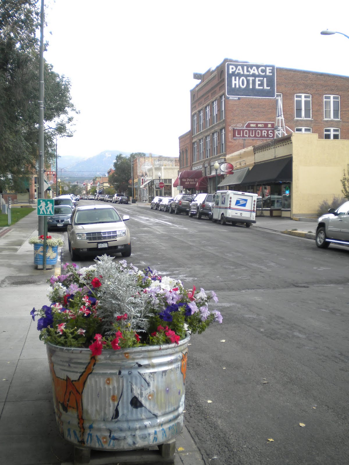
This leg of the trip was designed to shake things up a bit, to give ourselves a taste of a very different part of the U.S. To that end we haven't been disappointed. As I mentioned above, New Orleans was wonderful. I had been to the city in 1994, pre-Katrina, and I really feel it's a much better city now. It just feels a lot safer and cleaner in the French Quarter, and most of the properties show little if any scares from the hurricane. Of course, tourists can be notoriously superficial and shallow in their judgments of cities, and no doubt that's the case with me. For one, last time I was in New Orleans I stayed in one of the most terribly disgusting motels I could find, one that you literally had to run to each evening lest the muggers catch up with you. Moreover, staying in the French Quarter in a nicer hotel this time around probably helped shape my current view. Suffice to say, we made the most of walking around the city, enjoying plenty of the local food and beers. Budget be blown!

From New Orleans we travelled south by bike through the Garden and Audubon districts, travelling past many a beautiful southern home, cafes, restaurants, all under a seemingly endless canopy of trees through to a bike path that runs atop the Mississippi River levee. This path glided west for more than 20 gloriously serene and car-free miles, at which point we rejoined the traffic on River Road in LaPlace. We had cycled 50 miles that day, probably 8 or so more than originally planned thanks to us getting lost when leaving New Orleans (thanks Google Maps); a couple of friendly car mechanics put us right, pointing us towards a safe way to leave the city. There was really only one legal way for cyclists to leave New Orleans, the way we were doing it to the west, as the many bridges and causeways directly to the north and east of the city have no (legal) room for bikes.

The next day had us heading north along a frontage road next to highways 51/55. This road was wonderful. Very little traffic, large shoulders, and a great view of the swamps (pictured below) that the road was built through. As would become the pattern on most days in this part of the country, we would hit roads with heavy traffic nearer the end of each day. Much of this traffic seemed to build after 3pm onwards, and I guessed it was due to both school finishing and the many blue-collar workers heading home. Whatever the reason, with little shoulder to play with it could become quite stressful moving through some of the towns.

After spending our second night in Hammond, 35 miles north of LaPlace, we headed north until Amite, where we started our trek east towards Florida. We took highway 16 (great shoulder) until we reached Franklinton, 46 miles later, a town situated along the official Southern Tier bike route. We would follow this route until we reached Pensacola, and to be honest it was nice being back on an official trail as set by the Adventure Cycling Association (the same organization who mapped the Great Divide). It can get a tad hard working out (ie. guessing) the best way to travel between towns on bike.

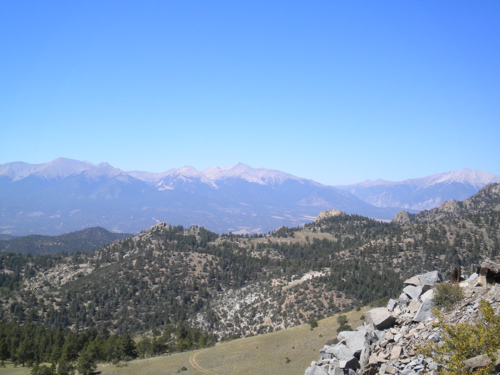
As we would find for most of the way, the roads in this part of the country were consistently rolling; hills weren't overly steep, and we were generally travelling through thickly-forested terrain, punctuated either by swamps or small farms. Some trees were changing colour; it seemed as if we had followed the Fall right across the US. After Franklinton we were determined to start camping again, partly for budget reasons but to also get us away from the often sterile environs of motels. Our first night camping was in Poplarville, 50 miles away, at a charming RV park just outside of town. What quickly became apparent was the amount of dew that would fall each evening in this part of the country. Just a few hours after sunset and the tent's flysheet was covered with water. By morning and you could swear it had rained overnight.

We camped again at our next stop, Perkinston, just 35 miles east of Poplarville, and again the overnight dew was intense. We were also ensuring we got into towns by 4pm at the latest, as the sun was setting by 5pm. Quite a change from our earlier days in B.C., where the sun wouldn't set until 10pm. In Perkinston we met two characters at the local RV park; the first talked at a pace F1 car driver Mark Webber would be thrilled to move at, although with his accent we simply couldn't understand him. Except for the odd reference to his brother, sister, ma or pa...and these odd pauses, which we later established were for him to catch his breathe. Perhaps. The other gentlemen wandered over in the morning, just when we were planning to eat breakfast and get ready to ride. With him was a small dog who had been recently mauled by one of the many (reversing) pickup trucks in these parts...If his dog's bloodied leg, bone exposed and all, didn't put us off our breakfast, the man's non-stop talking certainly did. Almost an hour later he was still there, talking away, totally ignoring our increasingly not so subtle hints for him to leave us. All the while his dog continually licked his wound. In the end we just started to prepare to leave, giving him the odd 'yeah mate', or 'right'...eventually he ambled away, his dog limping awkwardly (the dog was being looked after by a vet we were assured). People in these parts do love a chat. And whilst we generally welcome these chats, we've found they go on, and on, and on, and on....and nothing we do seems to give people the hint to move along.

The scenery was noteworthy once we moved past Vancleave (and a shitty RV Park that had the most disgusting washroom we had encountered), 49 miles from Perkinston, where we stayed overnight, and into Alabama. A highlight was the Pascagoula River Wildlife Management Area, where some of the swamps held your stare for quite some time. The lack of cars also made for some peaceful moments amongst the still waters and Spanish moss, so much so that we managed to spot a number of turtles sunning themselves on a half-sunken log.

The next day, beyond Bayou La Batre, was another highlight, taking us along part of the western shore of Mobile Bay and over Gordon Persons Bridge (with us pictured below at its zenith) and onto Dauphin Island. Traffic was surprisingly sparse, and the shoulders were generous. We had our first glimpses of the Gulf of Mexico, and the first whiff of salt air since leaving Prince Rupert in BC. Maybe it was being out from among the forest-lined roads, and into the open vistas we had become accustomed to in the West of the country that made this part of the trail that much more enjoyable. The climate was also wonderful; around mid-20s Celsius, modest humidity, and plenty of sunshine.

We took a car ferry from the eastern end of Dauphin Island - the site of one of the oldest (French) European settlements in Alabama (then part of French Louisiana), dating from 1699 - to Mobile Point. Along the way Pelicans plunged into the waters, and a small pod of dolphins edged ahead of our ferry. From Mobile Point we rode another 23 miles or so along a largely narrow peninsula, past brightly coloured holiday homes sitting proudly on stilts, to the town of Gulf Shores. The beaches along the Gulf Coast are beautiful - white sand dominates, and we're told the water is warm (too cold for us though!). We've had a relaxing time here, taking bike rides and walks to the beach or the shops, watching movies and reading books and or the newspaper. We also partook in Black Friday, the massive shopping day that immediately follows Thanksgiving. Moreover, we've sorted out how we'll be getting our bikes back to Australia (via a shipping company), and Alia has managed to catch up on some work, and me these blogs.

We've added another 363 miles and eight riding days since leaving New Orleans, bringing the total trip to just over 4000 miles and 95 riding days. Add another 45 miles and one day to these totals, and that's where we'll end it. What a blast, it really has been an amazing adventure. And now our thoughts turn to south of the border, to Mexico and Central America. I'm not sure if I'll do a blog for this part of the trip - I will let you know if we do. In the meantime, take care, and thanks again for reading my musings.

El Paso, TX to San Antonio, TX (via Austin)

We caught an Amtrak train from El Paso to Austin, leaving 8.15am on Nov 4. It seems so long ago now. The train trip wasn't too bad, although it wasn't as nice as I had hoped. Let's just say the type of person we shared the carriage with wasn't great (when the only two words a mother says to her daughter all trip is 'Shud Up", in that accent, makes you sad. Even sadder when, if only the mother had kept her own mouth shut she wouldn't have eaten enough to become the size of a house. Literally - she was HUGE. A lasting memory was of two men, their poor hands straining under her fat-laden butt cheeks, trying to push her up a moderate step back into the carriage).

Yet the views from the train were worth it, particularly near Alpine, TX, the gateway to Big Bend National Park and the Davis Mountains. And, what's more, we weren't having to peddle to enjoy it.

We arrived in Austin, the capital of Texas, the next morning at 9.30am (the train actually splits in San Antonio, with our train, the Texas Eagle, heading up to Chicago and the remainder heading onto New Orleans. Our carriages sit at San Antonio station from 9.30pm through to 7am the next day when it leaves. They allow you to stay on board and sleep in your seats).

Austin was a stark contrast to many American cities. Bike friendly, laden with trees, and a Downtown that engaged its populace and had attracted many even on weekends. The houses, for the most part, were simple one-storey homes clad with timber or Hardie-type cladding products. An abundance of trees added so much to their character; maybe its the drooping branches heavy with leaves that helps gives the place that relaxed, almost lazy feel. Youth pervades most aspects of this city as well, the result of the local university - the University of Texas - the home of the Texas Longhorns football team. Unfortunately (for me) they weren't playing at home this weekend although just seeing the stadium, a monolith on the university campus, showed just how much the team meant to the city.

Austin is also the home of Lance Armstrong, and he has a bike store located Downtown which we visited. No, not to score some artificial 'enhancements' for our own bike trip but to simply see some of his Tour de France yellow jerseys and bikes. We're both big fans of Lance, so we enjoyed the visit immensely. Contrast this to our visit to the Austin capital (parliament), and the portrait of George Bush, former Governor of Texas. Austin may be a liberal oasis but it remains surrounded by Republican Texas.

We spent five days in Austin before commencing our ride southwest to San Antonio, where we were due to catch a train to New Orleans. After consulting with a local bike expert we took the most direct route south, via San Marcos (where we spent the night) and New Braunfels. I have to admit it wasn't an enjoyable ride, as we basically followed Interstate Highway 35 on various frontage roads. The initial part of the two-day trip, through the Austin suburbs, was probably the nicest part. After that the roads rarely had shoulders, were almost always busy, and had countless numbers of trucks due to the prevalence of crushed limestone (used in concrete) quarries along the way. Our entry into San Antonio was the worst part, with us riding the final 20 miles along sidewalks as the traffic was that intense. We may have been tempted to stay on road if we didn't have large panniers on our bikes - at least cars can squeeze past you when you don't have big fat bags making you that much wider.

Despite a solid 54 mile day from San Marcos to San Antonio, we had more riding to do later that night. We just didn't realize it until around 9.30pm when Alia noticed a rather large bed bug making its way for her. This thing was huge. We think it had just brushed its teeth, put on its PJs and was making its way to bed. Further investigation revealed at least another six bed bugs, and a series of bites along my legs and arms (Alia escaped the bites for some reason). Long story short, we obtained an immediate refund from the owners and headed to a nearby motel we knew was better; upon entry to our new room we were careful to keep all of our bags away from the bed. The next day was spent washing everything we had, including our sleeping bags - so much for bed bugs being limited to the north east of the country (for those who aren't aware there had been a major outbreak of bedbugs in, amongst other places, New York City).

San Antonio, once you make your way through the outer suburbs, is a great city. It's famous for its river walk, a beautifully landscaped and pub/cafe heavy walkway along the San Antonio river through the heart of the Downtown, and the Alamo (pictured below with yours truly in front), where the Mexicans defeated a small heroic band of 'Texans' fighting for independence in 1836 (Texas, or as it was known Tejas, was then a part of Mexico). It was to be the last Mexican victory, and not long after Texas became an independent country, the Lone Star state. It wasn't until 1845 that Texas, burdened by the heavy cost associated with running and developing a country, joined the U.S.

Running south of San Antonio is a series of Spanish missions, set up in part to help repel an attempt by the French to grab some of the US for itself. The missions, run by Franciscan monks, also had their religious aims of course, primarily in turning the local Native American population towards God. Self contained, we visited four of five of the missions, riding along the San Antonio river for the most part along a designated 'path' (the path will actually be next to the river from 2011 onwards when they finish construction of a bikeway) for 10 miles or so. It was a pleasurable afternoon, topped off by an unplanned visit to a local bike store that was still (surprisingly) open at 6.30pm on a Saturday evening. My rear wheel had a very slight wobble and fearing some bent spokes, I simply put my head in to ask whether someone could look at it for me. Within five minutes not only had a mechanic fixed the wobble without charge but he had given us two free water bottles to take with us. The bike store's name - S. A. Cycles Bicycle Shop at 1804 St. Mary's. Give them a shout if you're ever in town!

My next blog will focus on the New Orleans, Louisiana to Gulf Shores, Alabama leg of our trip. Stay tuned!

Sunday, October 31, 2010

Magdelena, NM to El Paso, Texas (Mexican border)

After leaving Magdelena our thoughts turned very much to the Mexican border, and the few 100s of miles we had to travel. Still some way to go but the end of our north-south trip was very, very tangible now...I could almost taste the Coronas and burritos. I had even picked out the sombrero I would snooze under each lazy afternoon. Bueno. Ehh.

The road out of Magdelena was surprisingly steeper than expected...it's probably wrong to say steep, but just more rises than we had imagined. After 10 miles of steady uphill we crested and entered the rim of the Plains of San Augustin, and not too long after that we could see the day's highlight - the Very Large Array (VLA), a series of 27 radio telescopes that were featured, amongst other programs, in the movie Contact (albeit in a computer-enhanced manner). Each telescope, 25 metres in diameter, sits on one of three railway lines that each extend 13 or so miles in length. The telescopes can be moved in or out; when all the telescopes are spread out, it allows astronomers to look at a large part of the sky. When the opposite occurs, as it did when we were there, astronomers are focused on a smaller part of the sky. The telescopes sit within the Plains, essentially in a valley, to help protect them from unwanted electrical interference from nearby towns.


We camped that night at Datil Wells, 44 miles from Magdelena (via the VLA, which added 8 miles), at a very well run campsite. Each night we would look to the west waiting for an expected bout of bad weather that had been predicted days earlier. We were on alert after being drenched a few weeks earlier in the north of the state - we would often laugh about this, entering what we thought would be the driest state of the few we had travelled through, only to hit by the most water.

A few clouds appeared on this evening but nothing too sinister; the next morning saw a few spots of rain yet, for the most part of our 55 miles riding to Apache Creek, located at the junction of highways 12 and 32, it was more about gusting winds than water cascading from the sky. Today we rode deep within the plain, interrupted every 10 miles of so by modest hills flowing down from the mountains to our north. We rode onto the official Great Divide Trail just west of Old Horse Springs; one look down those hard, jumbled forestry roads sent shivers up my spine. We were more than happy to be on the pavement in this neck of the dirt. We crossed the Continental Divide, at 7300 feet, for our second last time...it felt satisfying to be back on the Divide, our companion from day one. Our old friend made us work hard over the course of this trip but she was relenting in this part of the country, her spine not so pronounced, the inclines more modest and sedate.


We camped beneath gloriously tall Ponderosa Pines at Apache Creek campground in the Gila (pronounced 'Heela') National Forest. The Gila, all of 3.3 million acres, wouldn't just dominate our horizon for the next week, it would also fill our heads with the history of Native Americans and the clash with modern America. Of Native chiefs lured to meetings on the pretence of peace, only to lose their lives and heads; of Geronimo, an Apache born and bred in these mountains, leading the US Calvary on a merry dance through its many canyons and mesas; and of infamous outlaws such as Billy the Kid, (partly) lured by the rich deposits of gold and silver found in the 1800s.

Our ride took us through the central and western sides of the Gila (and near the Arizona border), along highways 12 through Reserve and onto highway 180 through Glenwood and Buckhorn. The mountains to the east were magnificent. It was 26 miles into our ride from Apache Creek (about 13 miles from Reserve) that we had our first relatively major issue with our bikes. I had just noticed a wobble in my rear wheel/tire and asked Alia to look at it as I rode; she could see the tire clearly moving laterally, enough to have us plan to stop once we could find an open spot to do so - we were climbing through some steep hairpins on our way up to Saliz Pass (6436 feet) under a darkening sky, and just couldn't find enough space to pull over. We needn't have bothered; only seconds later and a curt 'POP' forced us to the tight confines of a corner of the highway. Not only had my tube burst, but my rear tire had been ripped along the bead for approx. 4 inches. A flawed tire wall had finally given way, putting pressure on the tube inside. As the rain began to fall we got the wheel off and removed the tire, yet as we attempted to use duct tape to repair the damage we could see it wouldn't hold enough to protect a new tube and any serious weight I would need to put on the bike.

Decision time.

In a surprisingly calm manner (well, for me at least. No outburst this time) we decided that we would walk to the nearest clearing (we could get enough air in the new tube to walk the bike) and begin seeing if someone could take us the 85 miles to Silver City. Failing this, we would simply walk around 12 miles and camp (we were in National Forest, which means you can legally camp anywhere excluding near streams/rivers), getting up the next day to walk the final eight miles to the nearest small town of Glenwood. From there we knew could order a tire from Silver City and have it Fedexed to us. Walking 20 miles really didn't faze us too much - we can walk at 4 miles an hour, and with our gear still on our bikes it wasn't too hard pushing my bike along. Obviously not our preference but well within our scope.

About a mile into our walk and a man stopped in a pull-out and asked us if we needed some help. We looked at each other and thought it made sense to see what this meant. Jerry, the man in the car, said he would happily take us into Silver City, not far from where he lived, and bring us back with a new tire...wow, what an offer. He couldn't take our bikes with us but these could be safely stashed in the dense bush near the road. Another glance between each of us. It seemed to make sense, and Jerry seemed genuine. And so it went; Jerry not only took us all the way into Silver City to get a new tire but allowed us to join him and his partner Mary for dinner, and put us up for the night at his house, located on highway 180 about 12 miles west of Silver City. How humbling. Such generosity I hadn't experienced. Ever. And Jerry was a lovely man, so humble and spiritual, so ready to listen to us and our laments.

After dropping us back at our stash site the next day, we cycled 21 miles to Bighorn campground at Glenwood. Both this evening, when we met a couple from Victoria, BC and a motorcyclist from Tuscon, Arizona, and the next day when we met locals at a Saturday farmers market, we were hit with how we seemed to be meeting so many nice people on this stretch of road. Not to say people weren't friendly earlier in the trip, it was more the sheer number of people we were meeting on this particular stretch of road. And it wouldn't end here; after taking in a local site called the CatWalk, an elevated walkway that takes you through a picturesque canyon just northeast of Glenwood, we made our way to Buckhorn for the night. The very next day, whilst having a coffee at a service station about 7 miles south of Glenwood at Cliff, we met Patrick, who was cycling back to Silver City. He was part of a local group of cyclists that had also spent the night in Glenwood as part of a weekend trip from Silver City. After chatting for about 10 minutes Patrick, who had only recently completed a solo bike trip from Silver City to his former home town in New York State (in just 41 days), offered for us to stay with him and his wife rather than the motel we had planned to bed down at. We accepted, and suffice to say, much like Jerry and Mary, Patrick and his wife Eileen, Irish Americans, treated us royally. We pretty much talked for two days straight, about anything from cycling through to Patrick's immense knowledge of the American Civil War. And in amongst this was an amazing fiddling performance by Eileen, the sounds of distant Ireland resonating sublimely through their adobe home.


We stayed with Patrick and Eileen for two days, two absolutely wonderful days. From Silver City was cycled up and down the cavernous bumps of highway 180 east to the junction with highway 152; from there it was up steeply past one of the oldest (copper) mines in the US at Santa Rita, an open pit monolith as big as anything we saw in Butte, Montana. Not long after we enjoyed a five or six mile descent into the Mimbres (Spanish for willow) Valley before recommencing what ended up being a grueling ascent to Emory Pass. For 15 miles we battled hairpin after hairpin, hoping that each one would be the last. It wouldn't, and it was only at 5.45pm that we finally crested the 8200ft summit, 2200ft above Silver City's elevation. The view to the east was immense; our view not only took in the surrounding mountains of the Gila Forest but also the distant Rio Grande valley...the scope and diversity of what we were seeing was astounding. Probably one the top three views on the entire trip. And the descent into Hillsboro was exhilarating, if not a tad scary on some of the turns as the wind pushed us this way and that, sometimes a bit too close to the edge of the pavement (and the canyon below). Just as the sun was setting, and about eight miles from our destination of Hillsboro, Alia had her very first flat tire of the entire trip. We laughed. Just wish it wasn't now, but then again I've said that on each of the ten times I had a flat. Always have to be somewhere by sometime.


We rode the final eight miles in darkness along a very quiet highway; no drama, and quite surreal in some ways, seeing the vague outlines of mesas and canyons as we glided by the light of our headlamps. The day saw us ride a solid 57 miles, enough to give us a deep sleep at the RV park in Hillsboro, an old gold town that was the subject of numerous Apache raids in the late 1800s. As isolated as we felt at times on this trip, in no way could it be compared to the early settlers in this part of the country, scratching out a living in the dry and dusty environs all the while trying to fend off attacks from marauding Apaches.
Our next day was a monster. After a three mile climb out of Hillsboro we glided down into the Rio Grande valley, entering just south of the wonderfully named town of Truth or Consequences. Just as an aside, the original name of this town was the rather uninspiring Hot Spring. According the local Chamber of Commerce website, the name was changed in response to an offer by a 1950s radio program named Truth or Consequences. The offer was simple - would any town change their name to help show how much a town enjoyed the radio program, now in its 10th year on air? The town, which was struggling to attract tourists, took up the challenge, and after a town vote in which 1294 to 295 residents voted yes, the name was changed. One of the weirder ways to develop a town name. But it caught my eye, so I suppose it works.


We continued south through a rich agricultural wonderland along the edges of the river, a benign topography of largely flat or downhill pavement of highway 185 adjacent to chili, cotton and pecan tree farms...on and on we went. We were making such good time that we arrived at our predesignated destination of Radium Springs by 5.30pm (after departing at our usual late time of 10.45am). A short chat, which brought up the lure of a shower and bed of a Las Cruces motel room, some 15 miles to the south, helped make a quick decision. We would push on. And so we did, at 14 miles an hour. We made the motel just before 7pm, some 77 miles (125 kms) from Hillsboro, our longest day of the entire trip by far. Felt good.
We enjoyed a sleep-in the next day, and whilst winds from the east gusting up to 20 miles per hour made life tad sour, we made it into El Paso, our final destination on this leg, by mid afternoon. El Paso wasn't a pleasant place to ride into, largely because I hadn't noted the best cycle route in. Instead we rode in along Highway 20, a 6-lane road that was very busy at the time we entered the city. We ended up riding along the sidewalk, which luckily was quite wide and continuous (as you discover in the US, many sidewalks just end arbitrarily, usually at the most inopportune spots along a road - i.e. the busiest spots).

So, now for the stats. Our total distance travelled to this point, including the Vancouver Island and Skeena River sections, was 3484 miles, or 5574.4 kms. The total number of riding days (ie. excluding rest days) was 87, or almost three solid months that our butts spent in the saddle. Ouch. Quite the ride, and one which took us through a roller coaster of emotions. Mostly good, and certainly enlightening to the extreme. I lost five kilograms, down from 86 to 81kgs (178 pounds), and two sizes, down from a 36 to 34 inch waist (as I discovered when buying a suit in Albuquerque). This whilst still having a beer or three every few days. I'll have to keep cycling when I get home, I like this flattish stomach thing.
Alia has replaced any weight loss with sheer muscle - did you see her calves during the wedding ceremony?!? Her father thinks that's why most people were crying during the ceremony - sheer astonishment at her beautifully shaped legs.

Yet the drama hasn't stopped in El Paso. On the Friday night just gone, whilst eating popcorn I chipped off a rather large part of my second molar, enough to expose the root. Ouch. I couldn't even finish the beer I was drinking, the pain was that intense. After searching for a local dentist (and wondering how much a US dentist would charge considering we only have insurance for AUD$500 for emergency dental), I found most weren't open on the weekend (nor on Fridays - gees, the golfing must be good here). Whilst conducting these searches on the Net, up came various websites promoting qualified dentists in the Mexican city of Juarez. Yes, that Juarez, the city with over 2000 drug-related murders each year, the city which sits adjacent to El Paso that we were planning to avoid like the plague. After reading quite a few independent blogs, I came up with a few seemingly reliable dental clinics in Juarez, each of which came and picked you up from your El Paso motel/hotel, took you to the clinic, and then returned you to your accommodation. All for dental prices that were a third charged by US (or even Canadian/Australian) dentists.
It's a thriving industry here (well, not so busy now as our driver pointed out - they once collected 100 people per day from El Paso, now it's 10 or so) simply due to the vast number of US citizens who can't afford health insurance - one lady who needed 5 crowns and three root canals was quoted $15000 in Atlanta; she paid around $4000 in Juarez, and was happy with the work (I accept that you can't really verify many of these claims but as best we could, we went to blogs that had no link to the dentists themselves).

So, off we went. Most dental clinics are located directly next to the border crossing, so you are basically only seeing a few streets in Juarez before you arrive. We were greeted by about three people at once, one of which explained each part of the process to me as it was being done (in clear English). I ended up needing a root canal and crown; I have to say that, at this stage, all seems good. The root canal was painless (well, after seven needles, what would you expect - part of me was waiting for a bottle of tequila and a blindfold) and, two days later, still painless. Today (Monday) sees me going back for the permanent porcelain crown (I have a temp in now), so assuming all goes well, both now and in the coming weeks, it may be something I recommend to others. Total cost was US$495, including all Xrays (three to date) and taxes. Alia's mother thinks it would cost at least three times that in Sydney.


But, no, I haven't told my mother about this incident as yet...

Again, not something I would want to do again, and only time will tell if the dental work lasts. Suffice to say, the message from this blog is anything that goes POP is to be avoided, whether that be tires with flimsy sidewalls or the corn you put in the microwave. A poor joke I know but someone challenged me to somehow link the two incidents. There you go.
I will continue to write on this blog as we commence our ride from Austin, Texas to San Antonio, and from New Orleans to Pensacola. We board a train to Austin this Thursday morning. Until I write again, take care, and thanks for taking an interest in our trip. It's appreciated.

Monday, October 18, 2010

Espanola, NM, to Magdalena, NM (via Las Vegas, NV)

We departed Espanola along highway 30, and the first 9.5 miles were fairly flat. That changed dramatically once we hit highway 502, the main road linking Santa Fe with Los Alamos, the city where the atomic bomb was developed. A busy three-lane highway, it climbed steeply through a narrow valley until we reached our turnoff four miles later, the junction with highway 4.

This was a scenic byway which we would travel along for the next two days. After having a lunch at the small town of White Rock, munching away whilst overlooking the meandering Rio Grande from the top of a cliff (pictured), we continued along the shoulderless highway 4 until we reached Bandelier National Monument. Traffic eased considerably after White Rock although it was persistent enough to keep us riding tight along the right-hand side of the road. The tricky part along this road was the many blind corners and crests - as you approach these sections you check to see (or hear) if any cars are coming in either direction, lest you encounter one at an inopportune time.


The scenery changed dramatically once we were out of the valley that Espanola sat in. From dry plains filled with scrub brush and the odd abrupt mesa tops, we glided through small gullies and canyons filled with burly Ponderosa pines, trees that were much taller than I would have expected in such a dry environment. Bandalier's visitor center sat within the Frijoles (Bean) Canyon; after riding 28 solid miles we still had another two miles to do - on foot this time. The reason? The main campground was closed due to renovations, so instead we walked to the nearest designated backcountry camping area. The Park staff were kind enough to let us leave our bikes near their own accommodation, so we were able to simply take our small backpacks, fill them with our tents, sleeping bags and dinner/breakfast, and make for the campsites. And what a lovely camping area it was. Set within the tight confines of the canyon, we had the place to ourselves - no RVs, no generators, no people. Just us. And was that noise I heard in the dark of night a bear...? A mountain lion? Or a coyote? A man in a rain coat? I don't know, and I didn't want to know at the time.

Our walk back to the visitor center early the next morning was a highlight. Instead of walking adjacent to a stream that carves its way through the ponderosa-pine filled canyon (this stream continues to flow even in drought, one of very few in the area that does), we took a path that took us next to the many former homes of the ancient Pueblo peoples. Inhabited as far back as 10,000 years ago, these cliff-face homes were built post 1150AD, highlighting how agricultural advancements led to formerly nomadic peoples to settle in what was a fertile canyon valley. You could clearly see holes in the volcanic rock where roof support posts were once inserted, along with countless pictographs of birds, faces and many other images. What made this place so special to us was how close you could get to the structures, along with the lack of tourists - we were now out of holiday season, the kids were back at school, and we were reaping the relative silence and solitude. It's hypocritical of course, as we are tourists too (special tourists, I always think), but gees it's great to have the 'space' to think about what you're viewing with the intense sounds of traffic and/or tourists bursting your ear drums.

We departed the Park for a campsite higher up in Sante Fe National Forest. Just how high was something we weren't aware of until we asked a few people. Up and up we went - the rise from the western turn-off to Los Alamos was particularly sharp. We were traversing along the side of a caldera, the remains of the very volcano that spewed the lava that Bandelier sits within. Again, the shoulder was non-existent on this stretch of road, although as we were stopping every half-mile or so for a breather (I estimated the grade was anywhere between 6-8 degrees), we were able to pull into what little room there was and let cars pass. One saving grace was the road was largely truckless.

Upon reaching the top we were treated to a view of the caldera, a vast empty hole filled with grass, and rimmed with pine trees. We had expected a sharp downhill at this point, yet the 'top' continued for quite some time - and up and down we went as the sun raced to the horizon (it always seems to be racing to the horizon when you're desperately trying to make it somewhere), only just making our campsite at Jemez Falls as the sun was setting. Luckily we had filled up with water before we commenced our ride that day, as the water at the campground had been turned off the day earlier - whilst we understand that they need to turn water off for the winter (lest pipes freeze), it would be great if they could say that somewhere earlier along the highway. Heaven forbid someone arrives with no water...then again, it was just another example of the myopic thinking focused on people with cars and RVs. They can easily move on. We can't.

The promised downhill came the next day. And what a glorious downhill it was, at 30 miles an hour through the steep confines of a red-rock canyon, again the remnants of ancient lava flows. We were travelling through the Jemez Mountains, and every turn yielded yet more stunning views of valleys and canyons topped by sheer red, orange and yellow coloured cliff faces. It was difficult to stay focused on the road ahead at times, although at least a shoulder appeared - not very wide but appreciated all the same. We stopped in at the hot spring town of Jemez Springs, site of another former pueblo town - this one had been usurped by the advancing Spanish in the early 1600s. We walked through the remains of the Spanish mission that had been established in 1621, the highlight being the stout church walls that still stood tall hundreds of years later. I hadn't quite appreciated how far north the Spanish had come - I know I mentioned this same point earlier in the blog when writing about the San Luis Valley in Colorado, yet seeing these walls made their former presence all that more tangible. The Spanish advance wouldn't have been a pleasant experience for the pueblo peoples, that's for sure.

We continued south along highway 4 until we reached the junction with highway 550. A three lane highway with a large shoulder, we traversed through more dry and arid scenery until we reached the outskirts of Albuquerque, or more accurately the town of Rio Rancho, what I was told is now the country's fastest growing region. We descended into the Rio Grande Valley, and into the city of Bernalillo (which sits adjacent to Rio Rancho) - to the south of the highway, along the gently-sloping ridge, sat countless one-storey homes all built in the earthy-coloured, flat roofed box-style that dominates many structures in the state, and mirrors the ways of the ancient pueblo peoples.

After 55 miles we camped adjacent to the Rio Grande in Bernalillo, and to a Casino that sits on a Native American reservation. How convenient - we showered, and then made straight to the dinner buffet. It was a welcome sight to these starved eyes. And didn't I make the most of it. Three mains courses followed by two desserts, all washed down by two large Sprites. I'm sure they wished they had charged me double. All along they had been warned about my brother's appetite (sorry Matty) - I'm sure I even saw my brother's photo there, just underneath the words WARNING: NO ENTRY TO THIS MAN.

I'll skip our time in Albuquerque, exceopt to mention the annual Balloon Festival, which we were lucky to see (we lucked out getting a third floor room that overlooked the valley - see the picture taken from the front of our room). We ended up staying in Albuquerque for 11 nights, interspersed with our wedding in Las Vegas, where we spent another five nights. We really enjoyed the break, and we both needed it. As did our bikes, which needed $200 worth of work at REI (thanks Chris!). I needed a new cassette, chain, and two new chainrings, new brake pads and a new cable and housing (for my gears)...Alia just needed a new chain. I seem to be riding quite hard compared to Alia. Really hard. Weird. Maybe it's my extra weight, both me plus the extra food I carry. Who knows. Or maybe Alia just caresses her gears and pedals while I hammer them.

We eventually set off from Albuquerque on Saturday Oct 16, and we cycled down along the Rio Grande valley. Albuquerque is blessed with many a bike path, both on and off-road, and for the vast majority of our trip out of the city we were on one or another bikeway (just for the record, we followed the North Diversion route to Indian Way, turned left onto Edith, and then made for Isleta Blvd, which is also highway 314). The cars gradually faded from view after we went through Belen, which sits 35 miles south of Albuquerque; a bit south of this city we pretty much had the road to ourselves, a well surfaced pavement gently rolling along the valley through majestic stands of cottonwood trees and small-scale pastures. It reminded me a tad of the Nile River valley, as once you were more than a 1km or so from the river you were back into arid and dry lands.

We were also travelling along El Camino Real, or the Royal Route, along which colonists from Mexico (as far south as Mexico City) came up into present day New Mexico and further, starting from 1598.

That night, after 55 miles, we camped at Bernardo, at a small RV park. We were basically adjacent to highway 25, although whilst the traffic could be loud at times we were that tired we slept easily through it all. Seemed weird being back in a tent again. I kept looking for the TV and refrigerator. And where was the bed? The next day we travelled along highway 25 into Socorro, the oldest Spanish settlement in New Mexico. We originally planned another 50-odd mile day but after learning a large part of the final 28 miles would be uphill, we erred on the side of caution (and entertainment - it was NFL Sunday after all) and pulled into a motel for the night, run by an Indian (i.e. south Asian) man who was amazed with the size of my calf muscles. Mmmmm. Better dead-bolt the door tonight Mrs Parker. (note - he was actually a lovely man, and he even upgraded us to a bigger bed so that we could have a proper rest)

Sure enough, the ride up to our present location of Magdalena, on highway 60, was fairly tough. We're glad we took the extra day to rest up, as we are finding it harder after such a long break. Magdalena is a small town of less than 1000 people, set against the backdrop of the Magdalena Mountains (well, what else would you name it?!?) and Cibola National Forest. On our way up (we ascended from 4850ft to 6500ft) we also crossed the Magdalena Fault. Magdalena, Magdalena, Magdalena - it's all about Magdalena (Lady Magdalene sits atop a nearby peak, looking down upon the town, according to the local Chamber of Commerce website). Once known as 'Trails End', it was where stock was brought along a corridor that stretched into Arizona in order to get them onto the spur rail line that once ran into Socorro.

From Magdalena we'll head west along highways 60 and 12; highway 12 runs into highway 180, which will take us south to Silver City, NM, and eventually Deming. From there it's a two-day ride into El Paso, Texas, from where we'll technically end our trail at the Mexican border. We then pick up a train to Austin, Texas, on Nov 4. We are off the Great Divide trail now, although we will cross the trail at least twice in the next week, the first time just near Horse Springs, and the second at Silver City. Rain is predicted, and we have no appetite for the rough and rugged New Mexican dirt/gravel roads. It's the pavement for us now. Until next time.

Sunday, September 26, 2010

Alamosa, CO, to Espanola, NM

We departed Alamosa and rode the flat and rather featureless 28 miles to Antonito, CO, where we had lunch in a non-descript park. Well, some freshly-laid grass and kids playground equipment, along with a few hard plastic seats and tables. Everything around this was dust and dirt.

We then headed west along highway 17 towards Chama, New Mexico. We were planning to get to a campground just inside Rio Grande National Forest, although after reaching the small town of Mogote, seven miles later, we found a very well-run private campground (Mogote Meadows). After 35 miles we had had enough, and the stop allowed Alia to do some work (they had WiFi) and have her regular Monday meeting. And, yes, I got to watch the NFL prime time game.

Highway 17 (pictured, left) is part of the Caminos Los Antiguos, which as you may recall we had been travelling along earlier in the San Luis Valley. From our guide we understood this particular section of the trail was one of the most spectacular bits of pavement in the entire southwest U.S. It didn't disappoint. From the featureless environs just east of Mogote we gradually twisted and turned our way into another stunning valley framed by sheer rock ledges and filled with the heavy yellows of numerous aspen groves. We rejoined the Great Divide Trail at the small town of Horca (we had been off the official trail for six days), at which point the road headed for the heavens - from around 8800ft just west of Horca to 10230ft in 5.5 miles at La Manga Pass, all at 5 per cent grade (or more at times). Throw in a short but sharp thunderstorm along the way (we jumped into a glade of pine trees and pulled the tarp over our head for this) and it was a challenge. The view over the Conejos (Rabbit) Valley, home to various peoples for 8000 years, was surreal. It reminded me of the Megalong Valley in the Blue Mountains near Sydney.

We camped for the night just off the highway, deep in amongst the pine trees at just under 10000ft in altitude. The night was brisk. Four cows in the next grove of trees kept us company, their eyes reflecting back at us each time we pointed our torches in their direction. For some reason we got a real kick out of this. Cows. They make us laugh, whether they're fleeing from us as we approach them on a remote dirt road (for no apparent reason, and usually at the very last moment so you're never sure of which direction they'll head), or just galloping up towards us in order to simply stare at the people on the bikes. Maybe their blank stares aren't symbolic of their lowly stature in the food chain but instead of a genuine concern for our mental health, the weird people on the bikes. Moo.

We had originally planned to head to Chama, in the U.S. state of New Mexico, entirely along pavement. That would mean leaving the Great Divide Trail again, and this time for quite a while. At the turnoff though we changed our minds. The day looked grand, and the offroad trail invited us into yet another aspen-filled valley. So, we left Highway 17 and turned south on Co. Road 117 (CO) and 87 (NM). We knew the dirt/gravel roads in New Mexico were tougher than anyway we had been but we still didn't quite fathom how bad they would get. We entered New Mexico a few miles after leaving the highway and the road surface rapidly deteriorated, from just a rough gravel road to nothing more than a rock-strewn path. And all up some sheer grades; at one point we had to push our bikes for over a mile up to the top of Brazos Ridge, not a pleasant task over rocks you could build a house with.

I do wonder at times why the trail takes us on roads that would otherwise be best left alone. Yes, these very roads more often than not take us to remote places with wonderful vistas. Yet I just can't imagine some of the people I've seen on the trail enjoying these stretches, none least than myself. Back to that fine line between pleasure and pain. You feel weak for seeking to avoid some of these stretches although you simply don't enjoy trudging up yet another bloody goat track - the Great Divide does have a few pavement-based alternative routes within New Mexico, largely due to how bad rain can affect these sections, and I would suggest they should do another one around this part. At least travelling along these alternates you feel like you're not cheating, that you're still part of the 'official' trail.

Rant over, on with the journey.

I feel like I'm getting a tad monotonous describing each new view we encounter. It's difficult describing some of them, they are just that big and grand, so far beyond the human scale. This particular vista was even more special as we could see as far as the section of the Sangre de Christo mountains that backed the Great Sand Dunes National Park, what I would estimate was 60-70 miles away, along with much of the San Luis Valley. Immediately in front of us though was the Cruces Basin Wilderness, a relatively compact valley again generously blessed with the sublime colours of Fall.

After topping out at 11000ft, we spent the afternoon making up time on better surfaces, gliding through think stands of aspen and open fields. Our goal was to get as close to Highway 285 as we expected rain the next day. And rain means impassable roads in these parts, even for high-clearance 4WDs. We ended up rough camping near the Rio San Antonio that evening, a night graced with a cloudless sky and an almost full moon lighting the landscape. The next morning we were greeted with the ominous sight of deep grey crowds moving in from the southwest, not a good sign. We again left the official route and made for Highway 285, which links Antonito (yes, we had almost completed a full circle through the mountains) with Tres Piedres, NM, a 'town' 25 miles away that had the usual collection of depressingly empty and boarded-up shops and gas station. We arrived just before a torrent of water descended from above; we ended up eating our lunch inside the local Post Office. Yet if we thought we had beaten the weather, we were severely wrong. We still had to ride another 31 miles to Ojo Caliente in the south, and we really had no choice - that was our only option for somewhere to stay for the night.

Three miles out from town, and down came the water. Well, not just down, but horizontally...in it came, a fire hose directed straight at us, the people on the bikes. It was hard at times to simply look up, the rain stinging our eyes and faces. On we went, luckily at a good pace due to the relatively flat mesa terrain we were on. Certainly not a preferred experience, instead just another unique set of circumstances we found ourselves in again, one we strangely accepted with a smile on our face for most of the way. We eventually descended into Ojo Caliente at around 4pm, although while the rain eased it was soon back to its soaking best just at the time we went to set up our tent at the excuse of an RV Park at Ojo Caliente Hot Springs Resort. Mud everywhere, a restroom complex that was actually just a couple of toilet-paper deprived and dirty Portaloos, and no shelter whatsoever. This for $23 a night. And all next to the decadent five-star resort that owned the place. Shame Ojo Caliente, shame! I did eventually get some money back after complaining but even then I had to push the manager - he kept agreeing with everything I said but would then just go silent...meaning I had to say I don't just want his words but something more tangible for the poor facilities. Like, MONEY YOU FOOL.

Our Macpac tent held up well considering, with just a bit water seeping in at the time we put it up. Condensation was our worst enemy, a light layer of water coating most things we owned. The next morning's sunshine certainly made us feel a lot better, allowing us to dry out all our wet weather gear and the tent, amongst other items. We spread our gear over three empty sites in an attempt to get as much sun as possible on our gear; three hours later and we were relatively dry again - until we hopped into the very hot pools we had sought out in the first place. Set against a small cliff face were a series of hotpools; two had arsenic in them, another iron, and another soda. All incredibly relaxing, and all welcomed after the previous day's exertions.

That afternoon we descended yet further through another valley to the town of Espanola, 25 miles south. There really isn't much to say about this town, except that it has a few characters that you wouldn't want to meet in a floodlit alley let along a dark one. As one resident we met described the town, it's ghetto man, ghetto. But it serves our purposes well. We're well and truly off the Great Divide trail now - it heads west through the towns of El Rito, Abiquiu and Cuba, and onto Grants. We plan instead to head south to Bandalier National Monument tomorrow (Monday Sept 27), and then travel along what is meant to be another spectacular roadway, that of highway 4 to Albuquerque via San Ysidro and Bernalillo. I expect we'll meet up with the Great Divide trail again in El Malpais National Monument, to the west of Albuquerque. That's after a McMullen becomes a Parker.

Until then, take care, and thanks for all of your best wishes on our impending nuptials.

Saturday, September 18, 2010

Salida, CO, to Alamosa, CO

Our first day's ride from Salida would not be forgotten by either of us. Not so much for the scenery this time, as good as it was heading up 10,842ft Marshall Pass. No, this time it was about Alia and I, and our future together. Yes, it was time to ask 'that' question - no, not whether we could buy a house next to Villa Park and buy a lifetime club membership. Or what was for lunch (and what time should we eat. Soon?).

No, it was time for the really big question.

It took me a while to get things planned but I managed to get it all together. The moment took place after we reached Marshall Pass, around 26 mostly tough uphill miles from Salida. Earlier that day, just outside Poncha Springs, we met Ed from northern California. He would get almost as much of a shock as Alia would once we reached the pass. After setting our bikes against a wooden sign at the top, I reached into my front bag and pulled out the ring; I walked over, handed Ed my camera (which has a video), knelt down and asked Alia if she would be my bike partner for life. She said yes, and I was thrilled. And we could honestly say it would be all downhill from that point - quite literally, as it was a three mile drop to our campsite for the night. It was an enjoyable descent (aren't they all), not least due to events at the top - adding to the ride was the sharp yellows of the aspens that lined much of the route.

Next morning we made the 10 miles to the small town of Sargents, a town on highway 50, where we enjoyed a cooked breakfast. Any time we ride through a town we generally try and take advantage of the local diner or restaurant, most of which cook up pretty good breakfasts and burgers, amongst many other things. And coffee. Lots of coffee. Please.

People have been curious about what we eat. If we're out on the trail, it's generally a breakfast consisting of a granola or bran cereal topped with prunes (don't they get me going) using milk powder,along with a coffee provided we have enough gas remaining (and I don't mean from the prunes) in our canister; lunch consists of sandwiches, usually with dried meats and cheese (the type that doesn't need to be refrigerated, with the happy cow on it. Moo.); dinners are usually pasta and/or rice based, along with mash potato as a starter (the potato comes in powder form, to which you just add hot water). Snacks include high-energy protein bars, Mars or Snickers bars, and plenty of trail mix. The longest period we generally have to pack food for is four days, although even on these stretches can come across some form of small general store or diner. In some ways water is the harder item to plan for and pack. We usually know where water can be found, as our maps are quite detailed. Yet at times we still need to carry 7-8 litres, as it takes time and batteries to filter and clean any water we consume from rivers or streams (we have an ultraviolet filter). And with one litre of water weighing around 1 kilogram (2.2 pounds), you can quickly see how weight can then become an issue - you really do feel it when you're cycling up the side of mountain.

Back on the trail from Sargents, we made our way along highway 50 until we turned south onto a dirt road that traversed a semi-desolate valley. The Elk Mountains, young and proud, beckoned to the west. After a total of 48 miles for the day we reached Dome Reservoir where we camped for our second night since leaving Salida. Ed was still with us, and he was great company - we appreciated having someone with us who was not only interesting in his own right (Ed is very much an outdoors person) but whose shared riding experience gave us a fresh perspective on the same trail we had traversed. Ask any rider and they love hearing about how others fared on the route, particularly the tougher sections - so it was no surprise that the Great Basin back in Wyoming featured prominently.


Our next day, 41 miles from Dome Reservoir to Storm King Campground to the southeast, would have us riding up two 10,000-plus passes (Cochetopa and Carnero). And, as only Murphy would have it, the second one was the much tougher one, just at the time late in the day when you've spent most of your energy.

The changing colours of the many aspen groves continued to captivate. Not just yellows but also oranges and reds burst through the otherwise largely green canvass. As we descended into the lower altitudes we rode through a number of wonderfully contorted and tight canyons, some with rock formations so life-like you found yourself staring at them while descending at 15-20 miles per hour on rough roads. And all savoured with no one else around, something that was noticeable on this third day.

From Storm King campground we made our way through another staggering rock formation, the grand basalt entrance to Coolbroth Canyon. Quite simply, wow. We stopped before it, beneath it, and after it...we just had to see this mass of rock from every angle possible. Our next stop, La Garita, little more than a general store/diner, saw us enjoy a burger and beer before we headed across the very flat and seemingly arid (well, not so as it would turn out) San Luis Valley. On the opposite side of this Valley was our next stop, the Great Sand Dunes National Park. We parted ways with Ed here - he continued south on the trail proper. His company would be missed.

We pointed our wheels east towards the distant Sangre de Christo mountains, sheer 14000ft peaks that sit as a stunning backdrop to the National Park. Maybe it was travelling on flat and paved roads again, and the extra ground you can travel, but our (well, ah, my) estimates of how long it would take us to get to the National Park were severely wrong. What I guessed would be a fairly easy 30 mile ride ended up being 45 miles and that only yielded us a campsite at San Luis Lakes State Park, still 12 miles short of the National Park (but a wonderful campsite all the same, as it looked over the sand dunes). Add to this the 15 miles we had travelled earlier in the day, and you have a total of 60 miles, or 100km. What made things a bit tougher was a poor choice of route by yours truly which saw us mired on a road so sandy that we had to walk a mile to the north to get to the nearest paved road, plus the unexpectedly high temperatures (we later learned that the San Luis Valley, at 8000ft, is a magnet for the sun, the best place for collecting solar power in the entire country. In a twist to this though, it's a haven for growing crops such as potatoes and carrots, as it sits upon a huge aquifier).

It was all well worth it. The Great Sand Dunes were absolutely amazing, billions of grains of sand so flowing and sculptured you swear a human hand had spent an eternity crafting them. We climbed the second highest dune in the park, at around 700ft, giving us a vista so magnificent I won't even bother to try and describe it. Suffice to say, get there yourself one day. That these dunes are backed by yet another stunning mountain range, that of the Sangre de Christo (Blood of Christ), only added to the spectacle. We camped just outside the park that evening, at Oasis Campground and Lodge, and while a privately run facility we found ourselves in a rugged and secluded site amongst gnarled pinon pines with seemingly endless views across the Park and San Luis Valley. Coyotes howled us to sleep again that evening, and not long before the sun flooded the valley once more we heard the 'who who-whos' of an owl. It's easy to understand why the Spanish left this as the northern border of their Americas territory, it's sheer remoteness and toughness still so easy to imagine and feel to this day. That, and the marauding Ute Indians, who were so effective on horseback at defending this region that no permanent settlement was made by white man in the area until the 1850s.

Our next day had us ride 33 miles to the town of Alamosa along what was the best bits of pavement we have cycled the entire trip, road 150 (part of the scenic byway named Los Caminos Antiguos, or Trail of the Ancients), and highway 160. The latter had a shoulder so large it really belonged on Arnold Schwarzenegger - no girly-man shoulder for this part of the country. At 2-3 metres wide we had plenty of room to move on what is a rather busy road.

Our next two weeks will see us enter New Mexico, and make our way to Albuquerque (again, off the official trail). To date we've cycled over 4000km, or 2600 or so miles. From there we'll take a week off and head to Vegas for our wedding, before returning and starting on the trail again. Until then, all the best.

Thursday, September 9, 2010

Kremmling, CO, to Salida, CO

From Kremmling, Alia and I headed south towards Silverthorne; by the end of the day we churned out 57 miles after our preferred campsite, at Blue River, was closed (the second one we had come to in Colorado that was closed). With only another 12 miles to Silverthorne, and three more after that to the next campsite at Heaton Bay, all on pavement, we decided to push on (we really had no choice). Luckily, we had enough time to do so - it was only 5.30pm.

The day itself had been fairly steady, with around eight miles of uphills including a solid four miles up 9153 ft Ute Pass, at around 6 per cent grade (we were ascending from a base of over 8000 ft, so not too bad). Certainly, the view from the top of Ute Pass along with the thrilling descent at 30 miles per hour (48 km/hr) on fairly new paved road made it more than worthwhile. As we motored down we gawked upon the Eagle Nest Wilderness (pictured), which included some staggeringly beautiful and rugged peaks.


The only negative was the behaviour of some (most) drivers on one (Co. Rd 3) of the gravel backroads leading to Ute Pass. Being Labour Day weekend, it was busy, so we understood the higher level of traffic - but to drive past two cyclists at speeds in excess of 50 miles an hour, rocks flying in our direction, wasn't too courteous. We even got the impression some sped up as they passed us. So at odds with Coloradans in general, whom had been so welcoming and hospitable to date.

Silverthorne is largely a Factory Outlet centre, complete with all the key brands. Good thing it was after closing time. And that was for me, not necessarily Alia. I do love my shopping, the result of some weird gene in my male body. Sale signs captivate; add to that Factory Outlet and you have my undivided attention. The entire city sits beneath the wall of Dillon Reservoir, one of Denver's water sources. The wall is quite a sight, towering above the buildings below.

We ended up cycling in the dark that night as we decided to eat dinner in Silverthorne. There are some nights we just can't fathom the idea of cooking yet more pasta or rice. The darkness made it a tad tough although we have fairly strong lights on our bikes, and (unusually) we were following a bike path the entire way. This 20 mile or so long path, which links Silverthorne with Breckenridge, was testament to the saying, 'Build it, and they will come'. The next day, admittedly the Sunday of a long weekend, saw hundreds of people out and about on the trail. You couldn't overtake on some sections, it was so choked with cyclists, walkers and parents pushing prams. So refreshing to see in the car-crazed U.S. (not that someone from Australia can really talk).

From Silverthorne, we dodged the cafe-lattes in Frisco and Breckenridge (OK, so we had one ourselves. Darling, we had too - both towns are laden with nice homes and snug eateries and cafes), and began our ascent of our highest pass to date - 11,480ft Boreas. Expect the worst and hope for the best they say - spot on in this case. The ride up was actually quite pleasant. Yes, really. After all, it was on a former railway line bed, and as such the climb was generally steady and sedate on an at-most four per cent grade. Still, we felt elated upon making the top (see Alia, pictured, as she makes it), the second highest point on the entire Great Divide trail. The former railway, which operated from 1884 to 1937, was a spur to Leadville from the main Denver line, and was largely used to transport the various minerals that were being mined in the area.


The small town of Como (pictured in the distance), named by the Italians that once worked on the railway, greeted at the end of what was a 39 mile day. And so did a couple of rather tasty Indian Pale Ale pints and a meal at the local pub/B&B. The proprietor, from London, England, allowed us to camp next to his fine establishment that cold and windy night. Our tent battled against some violent wind gusts throughout the night; at some points in the evening the tent, one specifically designed to handle the wind (it's a tunnel tent), barely struggled to stay upright.


The next day was no better. Whilst the first five miles had us moving with the wind at our back - Alia said she hurtled along at 40km/hr without pedalling - the next three saw us battle what had become an aggressive sidewind. We estimated wind gusts hit 40-50 miles per hour. Alia actually came off her bike at one stage (luckily she managed to jump off just as the bike keeled over). Walking through what was another barren landscape, one flanked with granite-encrusted mountains to either side of us, was our only option. With another 20 or so miles to the next town, our thoughts became rather grim. Just how far would we need to push? The wind continued to whip against us, hurting our ears and forcing us to stop at times in order to stop our bikes falling. My Touret's spurted forth once again (as in space though, in a howling wind no one can hear you. I can certainly testify to that).

Mercifully, we crested a rise and the road edged eastward again, giving us a tailwind once more. The scenery remained consistent throughout much of the day. We were in dry, dusty valley floors flanked by tree-covered mountains - it was almost as if everything green clung for dear life to the edges of the dry abyss we were forced to traverse. There were plenty of houses along the way, some staggeringly large and inviting (no matter how long we lingered out the front of these properties, no one would come out and invite us in for the evening...damn), most strategically placed amongst the very few rocky outcrops and clumps of trees there were. Property prices weren't too bad, particularly just south of Hartsel - $9950 for 5 acres. What a steal, or so we thought - until we learnt from a local that on whatever plots were being sold there were no natural impediments, not even a single tree, to the winds we had just fought against, plus it laboured under the weight of a winter that commonly yields 15ft of snow. Maybe not the investment hotspot we envisioned.

After 50 miles we found an illegal campsite just off the road; it was a cold night, one we were eager to get through. We both were very much looking forward to getting to the next town, a mere 25 miles away, of Salida. Between us and our three-day rest was the pass adjacent to Cameron Mountain, and views towards the majestic Collegiate Peaks (named after the key US universities, including Yale, Harvard and Princeton - see adjacent picture). All over 14000ft, they demanded your attention - unfortunately, so too did the road beneath us. Nothing too bad but with enough sharp turns and bumps to keep your eyes south of your tires.

As we had eaten breakfast that same morning a lone coyote had ventured within 50 yards of us. He would stop. Then scamper another 10 yards towards us. Stop. Scamper. Stop. Scamper. As he peered towards us I thought of Kevin Costner in Dances with Wolves; would this coyote, like Costner's Wolf, come close and dance with me? Before I could size up my potential dance partner his movement halted - by the sound of a car, one of only two to pass us since the night before. Off he scampered over the grasslands, headed for the hills. There would be no dancing with this coyote.

And so we made it to the lovely town of Salida, a town that has survived the onslaught of modernity with class and style. House styles are mixed, from art deco through to turn of the 20th century, yet all share an owner's meticulous care. With the Labour Day weekend over, so too are the holidays that kept many tourists out and about. I'm not sure how busy Salida becomes each summer, although with its wide, tree-lined streets and generous sidewalks, something tells me it retains a relaxed air throughout the busy season. That many come here seeking the great outdoors, that is, seeking nature over commerce, only adds to its laidback charms. It's a wonderful place to put the feet up.

Before I sign off please go to YouTube to view some very basic videos (from my camera) I have uploaded, one of which includes part of the rapid 2500ft descent into Salida. The other is from Yellowstone, and our Buffalo encounter. You can see these by using either of these links (you can't search for them otherwise): http://http//www.youtube.com/watch?v=YF_bj9Rd3jI AND http://http//www.youtube.com/watch?v=jLsXdtwXhBU


Our next phase will have travel through southern Colorado, and should include a visit to the Great Sand Dunes National Park.

Friday, September 3, 2010

Pinedale, WY, to Kremmling, CO

Greetings from another hotel room, this time located in northern Colorado. It's been another week or two full of highs, of challenges, of headwinds and tailwinds, of mountain passes (and more bloody passes), and of coyotes howling at our tent door.

You may recall we were bracing for one of the most remote sections of the trail, the Great Basin in southwest Wyoming. Essentially it's terrain not dissimilar to a desert, where water is scarce. Very scarce. We began from Pinedale, well rested and engaged in the task ahead. The first 25 miles or so had us on a fairly flat grade of pavement, always a treat to this cyclotourist. The Wind Ranges gradually faded the further east we travelled.

Our tires then touched the dirt; and it was dirt and sagebrush for much of the next 200 miles. Our goal that day was Little Sandy Creek, an informal campsite next to a fairly reliable stream. History was never far from our wheels. At one point, as our surroundings became increasingly spartan and remote, we crossed Buckskin Crossing, or more accurately the Big Sandy River. This was part of the trail many trappers, fur traders and emigrants used in the 1800s when crossing from the eastern US to the west. Throughout this part of Wyoming we criss-crossed many a trail of yesteryear, from the Mormon Trail through to the Oregon and California Trails. It's difficult to comprehend how tough it must have been travelling by horse and cart through this part of the country all those years ago; bikes are luxuries in this context.

After completing our 49 miles from Pinedale to Little Sandy Creek (pictured at sunset), we met a cowboy the next morning who looked after thousands of acres and the 2200 head of cattle that roamed them (forget fences, these are free range cattle). Amongst other topics, I mentioned how glad I was we were finally out of Grizzly bear territory (Pinedale is as far south as they range); he mentioned how cattle owners would budget for a 20 per cent loss of stock due to Grizzlies and, perhaps surprisingly to us, wolves (from the same batch inserted into Yellowstone, hundreds of miles away). He wasn't too complementary of the Grizzly population in particular, citing days where he would come across five Grizzlies on his travels. "We should just be allowed to shoot them, you know, just in the arse, not to kill them, but to ensure they know to associate pain with humans."


Our next day has us visiting South Pass City and Atlantic City, the last vestiges of civilisation before heading across the Great Basin. South Pass City (pictured) is now a preserved historic site, one based on its heyday when it was a gold-producing locale that attracted people from all over. We enjoyed an ice cream and Gatorade from the one and only General Store as we pondered our next legs, through the Great Basin.

The heat wasn't too bad at this stage, although some of the hills around South Pass and Atlantic City were tough, so much so we were often off our bikes and pushing uphill. The roads were of good quality though, hard-packed dirt and gravel that allowed for easy and reliable rolling. Nothing worse than having worked your butt off to get to the top of a mountain only to find the descent is marred by a road full of ruts and rocks, making for a slow and often dangerous ride.

From Atlantic City, a town a hundreds, we entered the long barren stretch towards Rawlins, WY. Our guide book suggested camping next to Sweetwater River, which was 10 miles from Atlantic. This would force us to travel 69 miles the next day, with just two water sources along the way - the first 11 miles from Sweetwater River (Diagnus Well) and the other located at the end of the day's ride (A&M Reservoir). I wasn't enamoured with this plan so, with the road quality good and the wind at our back, we decided to push onto Diagnus Well that evening.

We were glad we made this decision although, as we were to learn, it wasn't an easy ride. The next 11 miles were on roads more akin to rough tracks, and sand was a constant danger, as I learnt not once, but twice. Both times my bike hit heavy sand my front wheel basically stopped, and off I went...ironically, the very substance that instigated the fall made for a relatively soft landing. Alia had a similar experience but managed to stay upright. Just, she said. It took us over two hours to do the 11 miles, and after a search for the 'Well' - in this case just a lone pipe pumping out water from deep beneath the Basin (for animals and humans alike) - we made camp just before sunset after travelling a staggering 61 tough miles. We can be quite quick setting up camp (see picture - this was taken the next morning) and getting dinner prepared - around 30-40 minutes - but we couldn't be quick enough to beat the setting sun. It was quite the feeling, camping on an open plain with little more then sagebrush and sand as companions. Oh, and whatever that was that scratched around the edge of our tent that evening. The sky was clear, something I look forward to more and more as I get to know the constellations of the northern hemisphere.

I'm glad we pushed on that evening, as the next day was our toughest. After filling up with water (FYI, we purchased a three-litre Camel Back pack that sits on the rear of Alia's bike; it's insulated which is extremely helpful in hot weather. All up, we were carrying this plus another 4.5 or so litres in a combination of four bike bottles and a 1 litre pack. Just enough as it would turn out).

Up and down we went; the road remained heavily rutted and sandy for the first 10-15 miles of the day, and only then did it harden up and make for more 'pleasant' cycling. We pushed hard until lunch, at which point we had completed 30 miles. Out came the tarp, and we sat amongst the sagebrush looking east towards the uranium mine at Green Mountain, a name that must have been an easy choice considering the trees that covered most of it, a stark contrast to the brown sun-baked plains stretching from its base. A strong westerly was blowing us toward our destination; hard to imagine having to ride into a wind on a day like this.

So much of today's riding, for me at least, was mental. The actual riding was on relatively flat terrain, so that wasn't the issue. It's more the distance and the lack of water. On days like this one I often have to remind myself to look up and around at the scenery as I can tend to solely focus on the ground ahead. Keeping a rhythm is also critical, as is setting short-term goals. A snack mid-afternoon, for example, becomes something to look forward to. Again, perhaps I'm sounding negative. I honestly don't mean to when I share the pragmatics our ride. Alia is certainly more accepting of the challenges we face; I tend to spit the dummy at some point each and every day. Alia thinks I may have turret's syndrome. FXXXX. Really? No, I'm just another Parker, one who struggles with pressure and gets emotional rather quickly. OK, very quickly. FXXXX. Full credit to Alia though, she pedals along largely without complaint. Well, perhaps the odd complaint. About me and my short temper.

A&M Reservoir looked like an oasis when we finally pulled in there, 57 miles from Diagnus Well. Much of the water for this reservoir was being pumped up from below, creating a water source of perhaps 100 metres by 50 metres. Proghorns were sipping at its edges as we set up camp on its shoreline. I was in for a swim in no time at all, and after filtering the water we had a good drink and our usual dinner fare, mashed potatoes for starter followed by a pasta (or rice) dish. After settling into our tent for the night we were treated to our very first encounter with coyotes; it was late in the evening when Alia shot up in her sleeping bag. We had just listened to the howls and yip yipping of a pack of coyotes not too far from us. What got Alia's attention though was the moon shadow of one coyote immediately adjacent to our tent. Like, next to Alia's head. Silence. Some padded steps circle us. More silence. Howling from the distance. The silence lengthens. After some more time, an eternity perhaps, we semi-relax. The coyote is gone. Sleep comes fitfully.

Our final day on this remote stretch is relatively easy, with the majority of the 57 miles to Rawlins on pavement and highway. What hit us a bit harder than expected was the shifting winds as we crossed the Continental Divide just outside Rawlins. The winds shifted sharply and rapidly, with tailwinds becoming dangerous crosswinds in a flash. Crosswinds may not sound so bad except for the panniers we have on the rear of our bikes (but thankfully not on the front) - these give the winds some surface to play with. And don't they enjoy playing with us, hitting us from the east and west at irregular intervals. Not much fun when you're travelling on a 65-mile an hour highway (although one that thankfully had a generous shoulder for cyclists, something Wyoming excels in).
Rawlins was once the home of Calamity Jane, and she spent some time in the local jail there. We holed up in a cheap motel there for the night, catching up on some cleaning, eating and drinking. Our next stretch caught us a bit by surprise; I expected a relatively easy 48 mile ride to the next campground. Instead, we were hit by 25 mile-an-hour headwinds across another spartan (yet entrancing) landscape. We had been warned about the winds of Wyoming, and here they were in all their fury. Edging along at 5 miles an hour wasn't great fun. Neither was the sharp gradient up 7900ft Middlewood Hill. We managed to get to another open yet informal campsite at 40 miles (when I say informal, you can legal camp in many places along our route, unless posted otherwise. Our maps also indicate many informal campsites, many located near water sources as this one was), and yet again we settled into our sleeping bags against the backdrop of coyotes howling in the near vicinity. I had since learned they weren't considered a dangerous animal. But their howls can suggest otherwise, at least to this soft Aussie. A somewhat comforting thought was this would be our last day on the open plains of Wyoming - we would enter Colorado tomorrow. And whilst mountains and steep climbs beckoned, being surrounded by trees would at least (partly) shield us from winds.

And so it panned out. Entering Medicine Bow National Forest, we were immediately blanketed with thick forest, much of it the white aspen that would follow us through into Colorado later that day. Stands of aspen (see photo) give the otherwise green slopes dominated by conifers some depth and variety. Their leaves flutter in the wind, so much so you swear you're hearing a raging torrent of water. We hit highway 70, still in Wyoming, and it isn't long before we see the mountains of Colorado to the south (see picture below). I had forgotten how captivating distant mountain peaks can be. We head southwest along highway 70 before taking a sharp turn to the east along road 710 (which becomes road 129 in Colorado, four miles later). We wind along the Little Snake River, past increasingly lavish ranches, including Three Forks Ranch, which is owned (I later learn) by the owner of the Arizona Cardinals NFL team. Lavish is an understatement. I could have putted on their pastures, they were so well manicured. Alas, putting wasn't on the forefront of my mind - getting up and over the 8700 feet pass just before Columbine was. And that night, if possible.


We pushed and pushed. Quite literally in fact, getting off our bikes regularly to get up yet another wall of road. We didn't make it. Falling a few miles short wasn't the end of the world, or so we thought at least. We found a camping spot in Routt National Forest, out in an open field and near one single tree. A creek curved a 100 yards beneath us, and the impressive granite capped top of Hahn Peak sat to our south. Some hunters camped beneath some trees near us came over; we chatted about the lack of Bull Elk in the area (they can hunt them for two weeks each year). The sun had set, and we were ready for bed. Just as I was heading into the tent, I noticed an increasing amount of lightning to the west. Not a good sign, as most of the bad weather in this part of the world came from that direction. I rechecked our tent's lines, reset and tightened a few, and went to bed. Nothing much happened after that; the wind gusted a few times but nothing too serious.


It was later that evening though that all hell broke loose. The thunder woke me, but it was the sharp and intense flashes of lightning that grabbed my attention. Closer and closer is came. The wind intensified. Our tent was coping admirably. But with the lightning literally flashing all around us at this point, and the thunder (and storm) now above us, I wasn't coping so well. We lay prostrate on the ground, me praying for this storm to pass. The lightening was surrounding us; it lit up the tent a few times. I pulled the sleeping bag tighter around my neck, as if this would protect me. Go away, go away, was all I could think. That I'm writing this now tells you it did, but we have learned about where best to set up tent since that night - always under trees, and preferably nearest the smallest one of a large and tall bunch (the lightning will generally go for the largest tree). Thankfully we didn't camp next to the stream, as water is one of the best conductors of electricity there is. Anyway, lesson learned.

The next day saw us crawl our way up the pass and into the delightful confines of the Columbine Cabins general store, and a warm coffee. After yet more rain, which we waited out, we headed south through Hahn Village and Clark, rolling into Steamboat Springs, a skiing mecca, later that afternoon. We camped there for two days, spending our well-earned rest day hunting for new (rear) bike tires (which we fond - Michelin's), oil and groceries. Steamboat Springs wasn't as touristy as we expected; very laid back, bike friendly, and with a free shuttle bus that runs the length of town, starting literally metres from our campsite (about 1.5 miles west of town). We enjoyed our first sit down meal here, a great big steak that we cooked ourselves, and an all-you-eat salad buffet. Was it really rude to go back for thirds? Mmm, something to ponder as I loaded my plate up again.

From Steamboat we headed almost directly south, camping about 7 miles short of 8900 ft Lynx Pass. Again, we had planned to get to a camping site at the Pass but an unexpected detour which added four miles to our route undermined our efforts (a dam crossing was closed due to construction, meaning a circuit of Stagecoach Reservoir). This detour though did allow us to meet Chuck - what a great, great American name - and his wife, who only too readily restocked us with water for the final 15 miles of our ride that day. Chuck (I was tempted to ask him when Missing in Action 51 was due to come out - he did look a bit like Mr Norris) was synonymous with what people had told us about Coloradans. They are outdoors people, they are friendly, and they are only too happy to help. The trails are busier here, full of people doing active things. Are we really still in the US?

And, so, from just south of Lynx Pass, which we summit the next day (Sept 2), we eventually made our way to Kremmling, 34 miles away. We detoured off one part of the official Great Divide trail, one particularly onerous segment that would taken us down 2000ft in the space of a few miles towards Radium, only to then climb back at least half of that late in the same day. No thanks. We stood there for five minutes debating our decision - the road down was apparently OK but complete with sharp turns and some rocks. And some of the scenery was meant to be staggering. Yet mentally we weren't quite prepared for another dose of off-road mountaineering, which is what some of this ride often entails, so we instead ascended 9500ft Gore Pass (about two miles up from where we were), a relatively easy ascent considering it was on pavement. From there was coasted down another 11 miles of highway, hitting Highway 40 six miles north of where we are now.

Kremmling is a small town, one perfect for a lazy day doing our washing and catching up on things like blogs and watching movies. Yes, sounds shallow. But it's amazing how the body and mind just shuts down at times and fights against any sort of stimulus - whether mental or physical - or any kind. Or is that just me and my puny mind? Something to think about. But I can't, just not now, as Lara Croft and Tomb Raider is on....From here we'll head south to Salida, a town we hear many a good thing about. We plan to rest there for three days before heading on to the Great Sands National Park, and possibly Mesa Verde National Park (both of which are off our trail but very enticing). Some rather large mountain passes await to the south including a monster of 12000ft. Ouch.

But that's for later. Now, what's on after Lara Croft...?

Distance update - we've done 2249 miles todate, or 3600km, over 60 days of (actual) cycling. And who has the yellow jersey? Well, team Parker-McMullen isn't that competitive. But having a podium, champagne and some French models (male and female of course) at the end of each stage would be quite a motivator, wouldn't it?!?