The day itself had been fairly steady, with around eight miles of uphills including a solid four miles up 9153 ft Ute Pass, at around 6 per cent grade (we were ascending from a base of over 8000 ft, so not too bad). Certainly, the view from the top of Ute Pass along with the thrilling descent at 30 miles per hour (48
 km/hr) on fairly new paved road made it more than worthwhile. As we motored down we gawked upon the Eagle Nest Wilderness (pictured), which included some staggeringly beautiful and rugged peaks.
The only negative was the behaviour of some (most) drivers on one (Co. Rd 3) of the gravel backroads leading to Ute Pass. Being Labour Day weekend, it was busy, so we understood the higher level of traffic - but to drive past two cyclists at speeds in excess of 50 miles an hour, rocks flying in our direction, wasn't too courteous. We even got the impression some sped up as they passed us. So at odds with Coloradans in general, whom had been so welcoming and hospitable to date.
Silverthorne is largely a Factory Outlet centre, complete with all the key brands. Good thing it was after closing time. And that was for me, not necessarily Alia. I do love my shopping, the result of some weird gene in my male body. Sale signs captivate; add to that Factory Outlet and you have my undivided attention. The entire city sits beneath the wall of Dillon Reservoir, one of Denver's water sources. The wall is quite a sight, towering above the buildings below.
We ended up cycling in the dark that night as we decided to eat dinner in Silverthorne. There are some nights we just can't fathom the idea of cooking yet more pasta or rice. The darkness made it a tad tough although we have fairly strong lights on our bikes, and (unusually) we were following a bike path the entire way. This 20 mile or so long path, which links Silverthorne with Breckenridge, was testament to the saying, 'Build it, and they will come'. The next day, admittedly the Sunday of a long weekend, saw hundreds of people out and about on the trail. You couldn't overtake on some sections, it was so choked with cyclists, walkers and parents pushing prams. So refreshing to see in the car-crazed U.S. (not that someone from Australia can really talk).
From Silverthorne, we dodged the cafe-lattes in Frisco and Breckenridge (OK, so we had one ourselves. Darling, we had too
 - both towns are laden with nice homes and snug eateries and cafes), and began our ascent of our highest pass to date - 11,480ft Boreas. Expect the worst and hope for the best they say - spot on in this case. The ride up was actually quite pleasant. Yes, really. After all, it was on a former railway line bed, and as such the climb was generally steady and sedate on an at-most four per cent grade. Still, we felt elated upon making the top (see Alia, pictured, as she makes it), the second highest point on the entire Great Divide trail. The former railway, which operated from 1884 to 1937, was a spur to Leadville from the main Denver line, and was largely used to transport the various minerals that were being mined in the area.
The small town of Como (pictured in the distance), named by the Italians that once worked on the railway, greeted at the end of what was a 39 mile day. And so did a couple of rather tasty Indian Pale Ale pints and a meal at the local pub/B&B. The proprietor, from London, England, allowed us to camp next to his fine establishment that cold and
 windy night. Our tent battled against some violent wind gusts throughout the night; at some points in the evening the tent, one specifically designed to handle the wind (it's a tunnel tent), barely struggled to stay upright.
The next day was no better. Whilst the first five miles had us moving with the wind at our back - Alia said she hurtled along at 40km/hr without pedalling - the next three saw us battle what had become an aggressive sidewind. We estimated wind gusts hit 40-50 miles per hour. Alia actually came off her bike at one stage (luckily she managed to jump off just as the bike keeled over). Walking through what was another barren landscape, one flanked with granite-encrusted mountains to either side of us, was our only option. With another 20 or so miles to the next town, our thoughts became rather grim. Just how far would we need to push? The wind continued to whip against us, hurting our ears and forcing us to stop at times in order to stop our bikes falling. My Touret's spurted forth once again (as in space though, in a howling wind no one can hear you. I can certainly testify to that).
Mercifully, we crested a rise and the road edged eastward again, giving us a tailwind once more. The scenery remained consistent throughout much of the day. We were in dry, dusty valley floors flanked by tree-covered mountains - it was almost as if everything green clung for dear life to the edges of the dry abyss we were forced to traverse. There were plenty of houses along the way, some staggeringly large and inviting (no matter how long we lingered out the front of these properties, no one would come out and invite us in for the evening...damn), most strategically placed amongst the very few rocky outcrops and clumps of trees there were. Property prices weren't too bad, particularly just south of Hartsel - $9950 for 5 acres. What a steal, or so we thought - until we learnt from a local that on whatever plots were being sold there were no natural impediments, not even a single tree, to the winds we had just fought against, plus it laboured under the weight of a winter that commonly yields 15ft of snow. Maybe not the investment hotspot we envisioned.
After 50 miles we found an illegal campsite just off the road; it was a cold night, one we were eager to get through. We both were very much looking forward to getting to the next town, a mere 25 miles away, of Salida. Between us and our three-day rest was the pass adjacent to Cameron Mountain, and views towards the majestic Collegiate Peaks (na
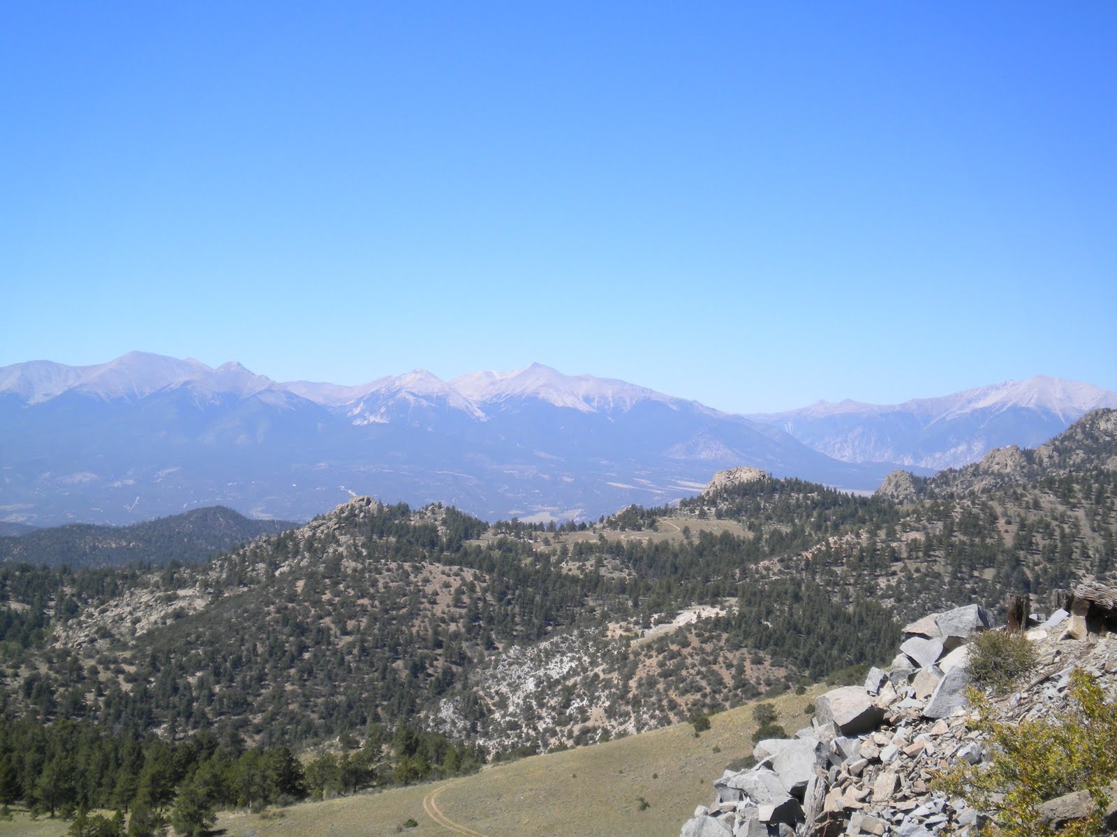 med after the key US universities, including Yale, Harvard and Princeton - see adjacent picture). All over 14000ft, they demanded your attention - unfortunately, so too did the road beneath us. Nothing too bad but with enough sharp turns and bumps to keep your eyes south of your tires.
As we had eaten breakfast that same morning a lone coyote had ventured within 50 yards of us. He would stop. Then scamper another 10 yards towards us. Stop. Scamper. Stop. Scamper. As he peered towards us I thought of Kevin Costner in Dances with Wolves; would this coyote, like Costner's Wolf, come close and dance with me? Before I could size up my potential dance partner his movement halted - by the sound of a car, one of only two to pass us since the night before. Off he scampered over the grasslands, headed for the hills. There would be no dancing with this coyote.
And so we made it to the lovely town of Salida, a town that has survived the onslaught of modernity with class and styl
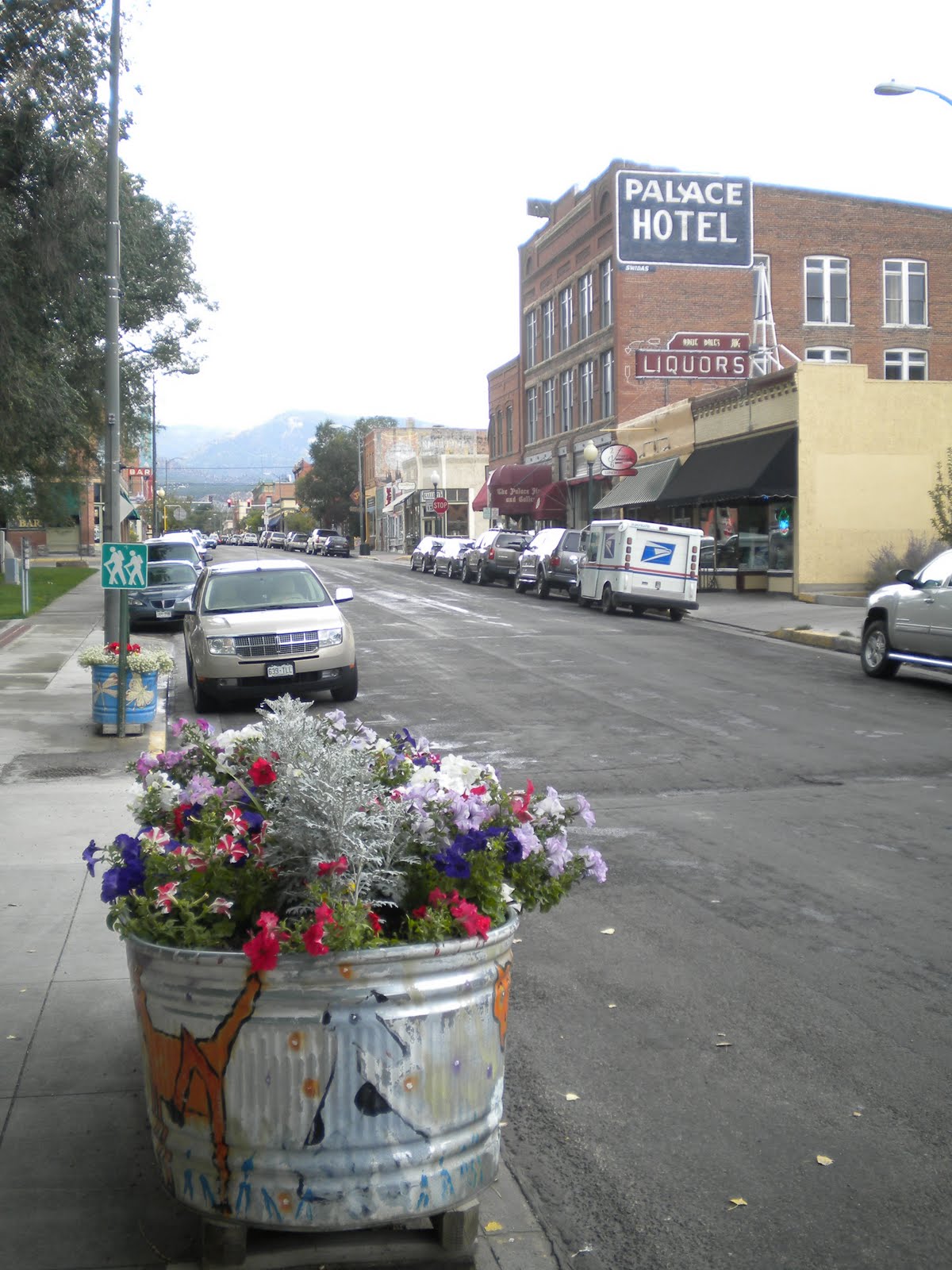 e. House styles are mixed, from art deco through to turn of the 20th century, yet all share an owner's meticulous care. With the Labour Day weekend over, so too are the holidays that kept many tourists out and about. I'm not sure how busy Salida becomes each summer, although with its wide, tree-lined streets and generous sidewalks, something tells me it retains a relaxed air throughout the busy season. That many come here seeking the great outdoors, that is, seeking nature over commerce, only adds to its laidback charms. It's a wonderful place to put the feet up.
Before I sign off please go to YouTube to view some very basic videos (from my camera) I have uploaded, one of which includes part of the rapid 2500ft descent into Salida. The other is from Yellowstone, and our Buffalo encounter. You can see these by using either of these links (you can't search for them otherwise): http://http//www.youtube.com/watch?v=YF_bj9Rd3jI AND http://http//www.youtube.com/watch?v=jLsXdtwXhBU
Our next phase will have travel through southern Colorado, and should include a visit to the Great Sand Dunes National Park.

Hey guys! Love reading about your trip. My mother, her husband, and I met you guys at the North Fork Hostel in Polebridge. I'm not sure if you guys will remember that, but there you are. Lots of luck in your adventure! We're excited to keep reading your journal. If you're ever near Marquette, Michigan, feel free to contact us for a place to stay and a meal. :)
ReplyDeleteOh, and I don't think your youtube links work. I had to delete the extra 'http' part.
Hi - Alia and I do remember you all! Actually, I thought of your father when the Vikings (and Farve) opened the season!!! Thanks for following the blog, we really enjoyed your company that night. Thank you for the offer of a room and meal - the same applies to you all if you make your way Down Under one day. Take care, and I hope you continue to enjoy the blog. Simon.
ReplyDelete